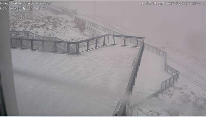
On Thursday, September 5th, The National Weather Service (NWS) in Pueblo, CO posted on their Facebook feed:
Its snowing on top of America’s Mountain this morning! Tis the season with fall like temperatures in store across south central and southeast Colorado today! (Pikes Peak webcams via city of Colorado Springs)
See the image at the head of the post.
The Area Forecast Discussion issued by NWS Pueblo noted cooler temperature and precipitation:
Currently…an upper level storm system is currently dropping south
into northwest Colorado early this morning. Energy ejecting
eastward from the upper system has led to the development of showers and embedded thunderstorms across Teller and El Paso Counties. This area of precipitation will continue to track east through daybreak.
More isolated shower activity is developing across the Plains and
will be hit and miss this morning. Cloud cover has helped keep
temperatures up this morning, with most areas across the Plains in
the 60s. Northerly winds continue to be gusty across the Plains
with gusts near 25 mph.
At the elevation of Pikes Peak, 14,115 feet, it was cold enough to turn rain into snow. The temperature drops about 3.5 degrees for every 1,000 feet of elevation, which is referred to as the “standard lapse rate.”


