Image: National Weather Service, Seattle via Twitter
A deep dip in the jet stream is bringing snow and cold to the Pacific Northwest (PNW). Forecasts indicate that in addition to the cold wave, as much as 8 feet of snow may accumulate in the Cascade Mountain Range from this storm.
AccuWeather meteorologist Bill Deger writes on Yahoo News:
The AccuWeather Local StormMax™ is an incredible 100 inches [of snow] for the series of storms expected through the rest of the week.
…
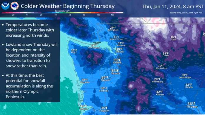
The cold air will also drop snow levels-the elevation at which precipitation starts to fall as snow-close to sea level to end the week and start the weekend in the Pacific Northwest. This means that cities such as Portland and Seattle can get some accumulating snow at times, along with temperatures that will be below freezing for multiple days.
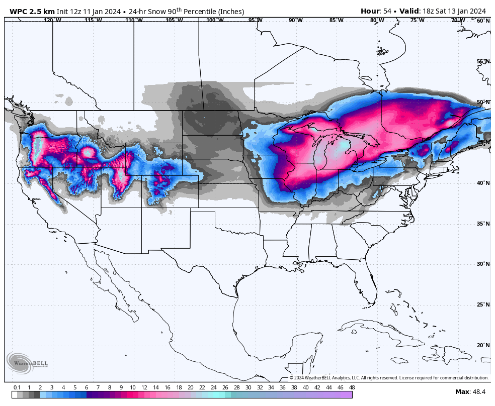
The snowfall forecast model from WeatherBell.com seen below, shows the PNW, Idaho, Eastern Nevada, and Utah receiving significant snowfall through Saturday night.
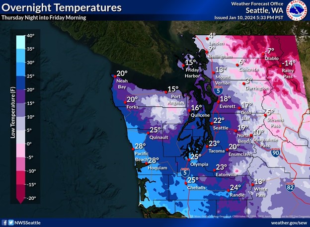
The condition for heavy snowfall is setup by the freezing cold temperatures invading the region. The National Weather Service (NWS), Seattle, WA provided a regional temperature map (seen below) and writes on Twitter:
Alright everyone, it’s going to get cold. Temperatures will drop fast Thursday night & be very cold through the weekend. Wind chills will also drop to single digits & teens Thursday night, with below 0 wind chill for Whatcom County & San Juan Islands.
Yahoo News has reported that Great Falls, Montana saw its temperatures drop below zero on January 10, and are expected to remain there for most of the next five days. It is possible, AccuWeather says, that overnight temperatures there could drop as low as 40 below zero during that time period.
The NWS also notes the possibility for record cold temperatures on Sunday:
Seattle forecast low of 14° Sunday morning would be the coldest temperature in Seattle since 2010. If it gets below 14° it will be the coldest since the 1990s.


