


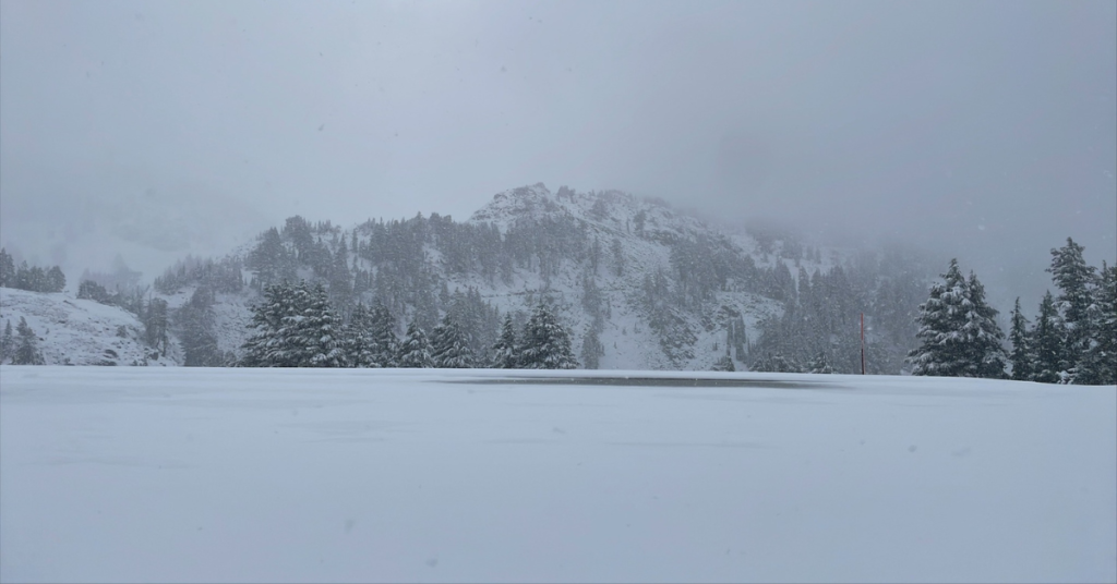
Image: Mount Shasta, CA, on August 24, 2024. Credit: Robin Kohn via Mt. Shasta Fun Guide (shared with permission)
A low-pressure center, dubbed a “weather anomaly” by NewsWeek brought snowfall to much of the mountains in Northern California. The National Weather Service (NWS) in Reno, Nevada, reported a “winter-like cold front” that moved in from the North Pacific, Friday Night and Saturday, significantly colder temperatures, rain and even snow to the Cascades, Sierra Nevada Mountains, and Lake Tahoe region.
Starting with Mount Shasta at the far north end of California, snow was seen to cover the mountain on Saturday (see the feature image above), according to SnowBrains.com
While Palisades Tahoe and Mammoth Mountain received a dusting in the last couple of days, Mount Shasta received almost 16″ of fresh snow.
According to ActiveNorCal.com, to the Southeast, “Lassen Volcanic National Park’s Highway 89 is currently closed between Sulphur Works and Devastated Area due to an unexpected snowfall of about 4 inches last night, with more snow expected throughout the day.”
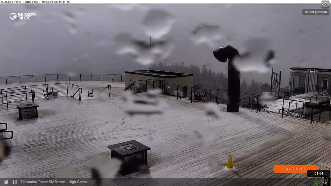
The UC Berkeley Central Sierra Snow Lab reported on Twitter:
As expected, we have seen a few flakes of #snow occasionally mixed in with the rain at the lab. The rain/snow line is around 1000-1500 feet above us, so we are seeing it on the mountain peaks around us. This is the view at @palisadestahoe Base Camp at 8200 feet!
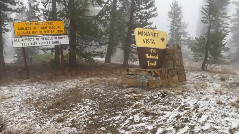
Further South, the Madera County Sheriff’s Office posted a video on Facebook with this description:
“August Snow Surprise at Minaret Vista! Eastern Madera County is experiencing some rare August snowfall at Minaret Vista, captured by none other than Deputy Rich, who’s up there on duty today—and it’s his birthday!
While it’s rare to see snow this time of year, it’s a reminder of the unpredictable nature of our beautiful Sierra Nevada.”
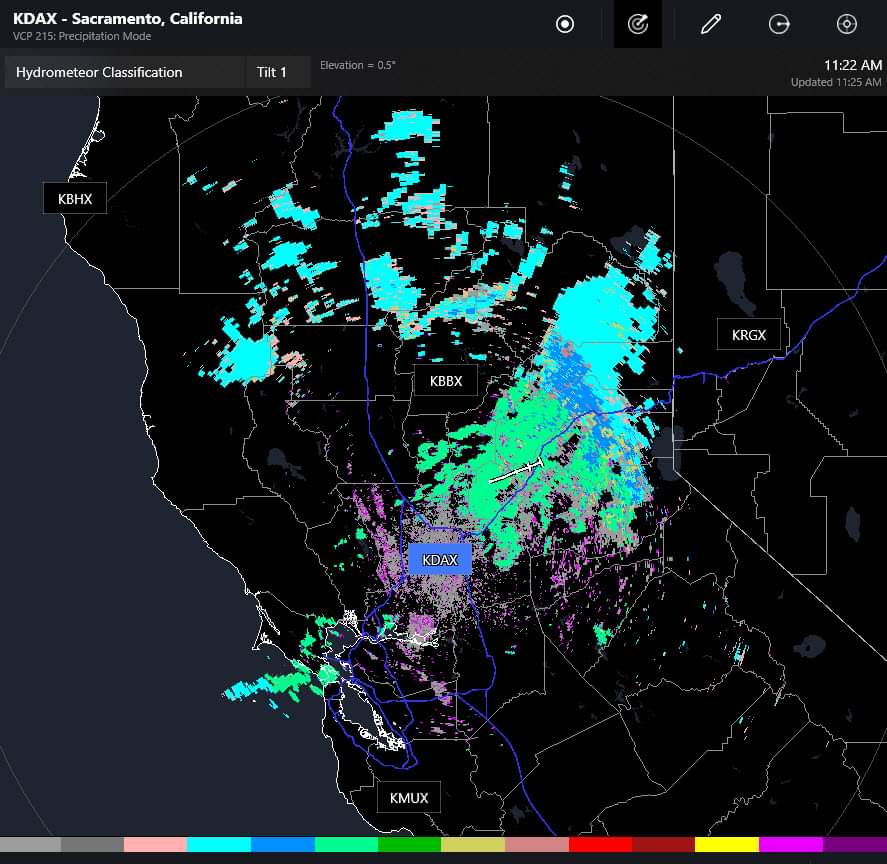
Drivers on I-80 over the Sierra Nevada reported a combination of snow and ice pellets during the drive from Reno to Sacramento as seen in this radar image below taken at 11:22AM on Saturday:
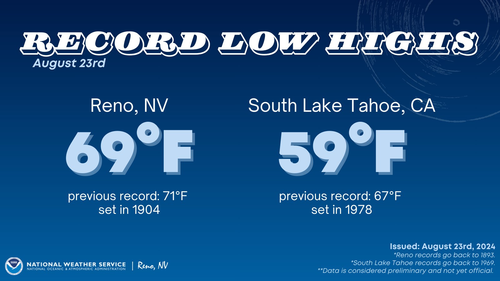
New cold temperature records were set during the weather anomaly. The NWS in Reno noted on their Facebook page,
Temperatures were record-breaking cold today! Daily record low high temperatures were set in both Reno and South Lake Tahoe today.
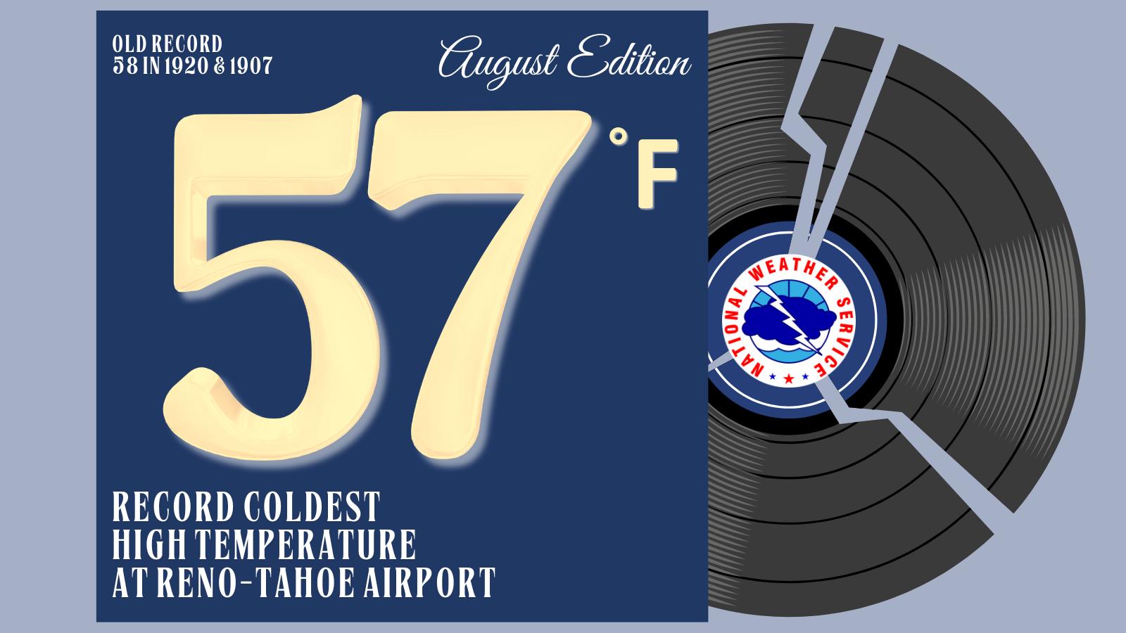
The NWS added on Saturday, “More records have been broken as today’s high of 57 degrees at Reno-Tahoe Airport is the all-time lowest high temperature during the month of August!”
Due to the colder temperatures accompanying this storm system the NWS in Reno also issued a frost advisory for some parts of northern and central Nevada for Saturday night through Sunday morning:
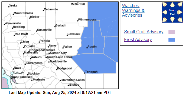
WHAT…Temperatures in the low to mid 30s will result in frost formation. The colder locales can expect temperatures in the upper 20s.
* WHERE…Northern Elko County, Ruby Mountains and East Humboldt Range, Northern Lander County and Northern Eureka County, Southern Lander County and Southern Eureka County, Southwest Elko County, South Central Elko County, Northwestern Nye County and Northeastern Nye County.
* WHEN…Until 9 AM PDT today (Sunday).