


Image: Snow in Herriman, UT on May 5, from Andrea K on Twitter.
KSL-TV in Salt Lake City reports on a spring storm that seemed more like one typical of winter that swept through the area earlier this week:
A cold front brought spring snow of up to two feet in some mountain areas and up to 8-10 inches in some places across the Wasatch Front and more is expected Tuesday. The National Weather Service issued a freeze warning and winter storm warning on Tuesday for multiple areas along the Wasatch Front.
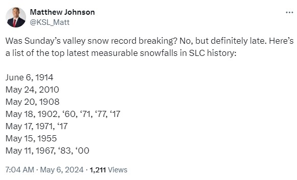
The late season snowstorm from over the weekend into Tuesday is not the latest snow to hit valleys in Utah history.
Before the storm arrived, the National Weather Service in Salt Lake City posted the graphic below and this notice on their web page and social media:
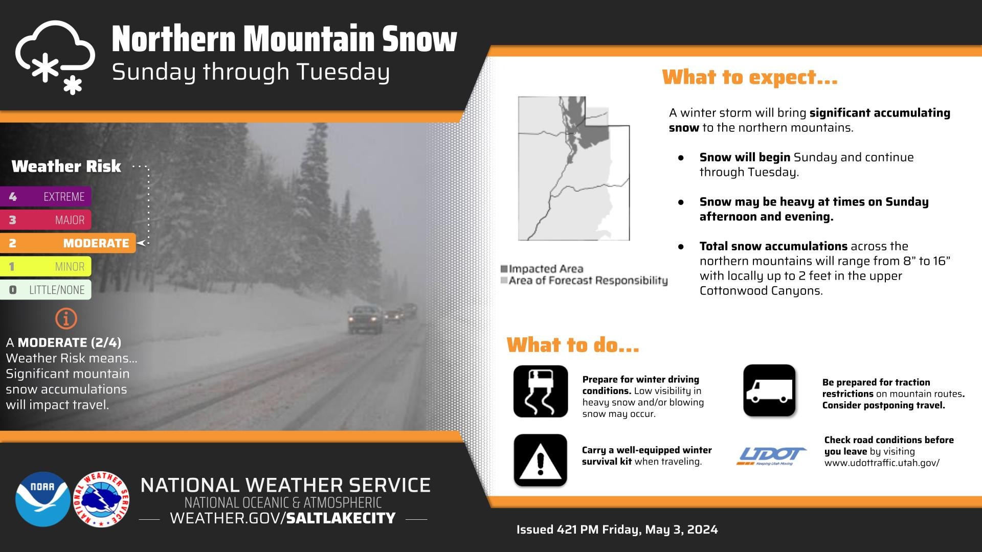
A significant late season winter storm is expected to impact Utah from Sunday through Tuesday. Significant mountain snow across northern Utah is expected through this time, with the heaviest period anticipated on Sunday. Total accumulations of 8 to 16 inches are likely.
On Twitter, KSL’s Matthew Johnson noted that there was significant precedent for late spring snowstorms throughout the weather history for the area:
After the storm passed, temperatures dropped as much as 30 degrees Fahrenheit in a single day, and the NWS issued freeze warnings, saying:
Morning temperatures will be below freezing for several portions of Utah Wednesday. A Freeze Warning is in effect for the shaded locations on the map. Make your necessary protections for outdoor plants and agriculture.
