
Image from Central Sierra Snow Lab near Donner Summit
The first major winter storm of the year dumped as a much as a foot of snow at the highest elevations of the Sierra Nevada mountain range this past week. More is expected this coming weekend from another storm.
The UC Berkeley Central Sierra Snow Lab reported on their Facebook page Wednesday January 3rd:
We received 10.8″ (27.5 cm) of #snow in the last 24 hours. Our season total is now 42.5″ (108 cm), which is 38% of average to date. We are expecting another 0-2″ today.
We are keeping an eye on this weekend’s storm, which currently looks to be similar magnitude.
They updated their report a day later stating:
Another 1.2″ (3 cm) of #snow over the last day brings our 2-day storm total to 12″ (30.5 cm).
Models still show disagreement for this [coming] weekend’s storm. Most suggest snowfalls of ~6-12″ at CSSL but one is indicating up to two feet. As the one model (GFS) is currently a substantial outlier, we’re leaning towards going with the lighter snowfall amounts for the forecast. We’ll be watching them closely as the new runs come out and will pass information on when we have it.
One thing is certain with this storm, it will be a cold one. So, snow is expected to be light and fluffy!
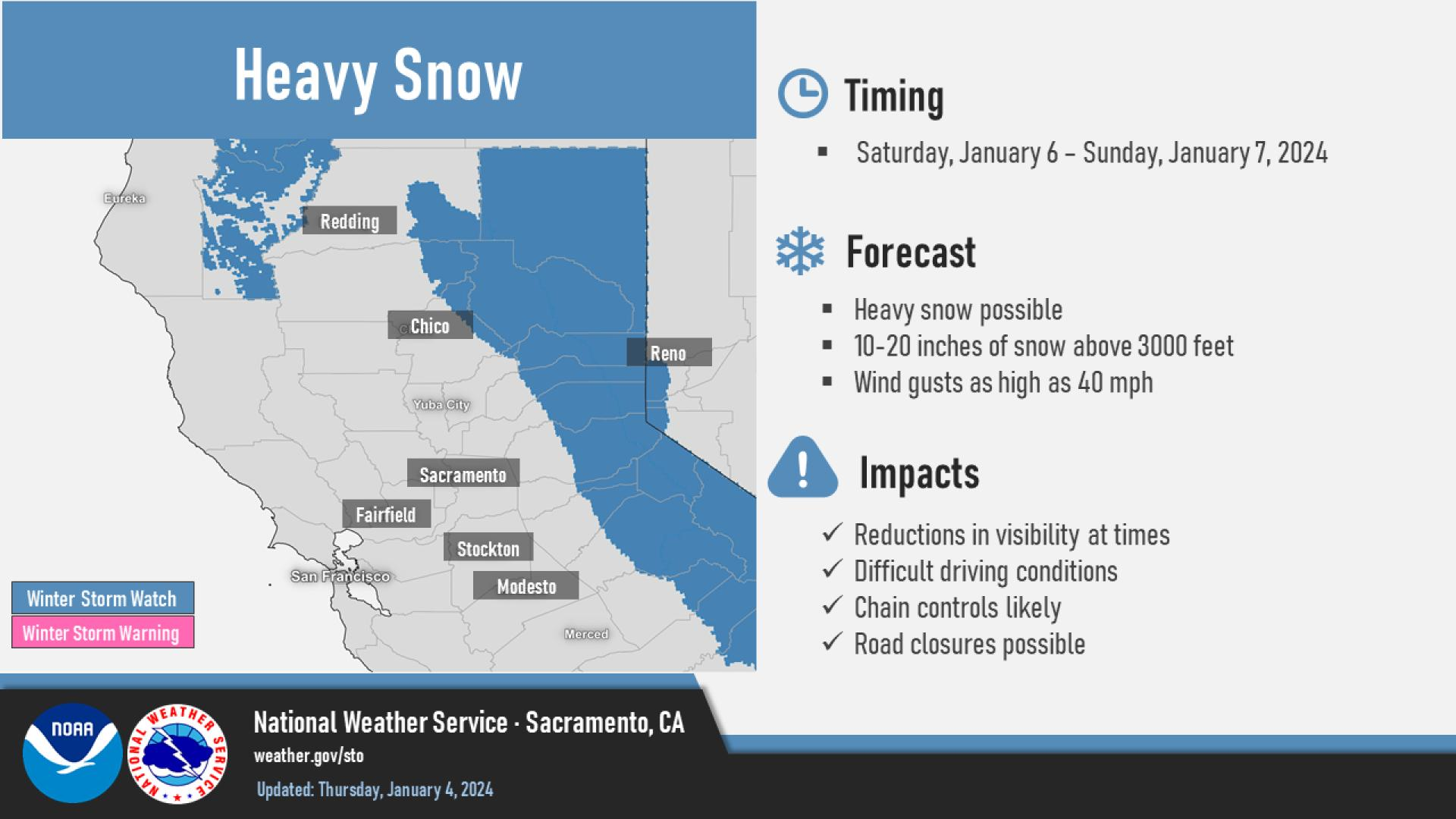
The National Weather Service has issued a Winter Storm Watch for the area this weekend and provided this graphic of estimated snow totals: