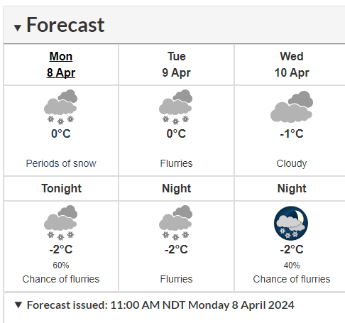
The Weather Network reported that a “bomb cyclone,” could result in below freezing temperatures, heavy snow, and high winds battering Newfoundland and Labrador on April 8th and April 9th.
“An upper-level trough swinging over eastern North America will give rise to a potent low-pressure system in the western Atlantic Ocean on Monday,” writes the Weather Network’s digital creators. “This system could strengthen so quickly that it may meet the definition of a ‘bomb cyclone’ as it reaches Newfoundland.”
Weather forecasters with the Weather Network and Environment and Climate Change Canada (ECCC) expect snow to fall across the entirety of Canada’s easternmost province with some communities receiving as much as 40 cm of snow, including St. John’s where the province’s international airport is located. Even deeper snow totals may fall across the southwestern corner of the island part of the province due to the sea-snow effect.
The ECCC reports residents of and visitors to the province should expect “periods of snow,” and “flurries,” continuing through Tuesday and likely into Wednesday, accompanied by near zero to below zero temperatures and high winds.
The snow combined with wind gusts possibly exceeding 80 to 100 kilometers per hour is likely to create hazardous travelling conditions, ECCC warns.
“Travel will be hazardous as a result [of the strong winds], especially during the afternoon commute on Tuesday when the blowing snow is expected to be most widespread,” ECCC reported.


